Forests on the Radar
10/25/2019With freely available radar data from satellites, biodiversity in forests can be analysed very well. In Nature Communications, researchers report that biodiversity even of tiny insects can be reliably modelled from space.
The quantity and diversity of plants and animals, especially insects, is decreasing, also in Germany. For this reason, science would like to see opportunities to document the biodiversity of the planet as extensively and comprehensively as possible. In this way, it could be determined whether measures against the insect dieback are effective or not.
Satellite data are well suited for this purpose. "So far, however, they have hardly been used. Scientists were of the opinion that there were no freely available data that would provide sufficientresults," says Professor Jörg Mueller from the Biocenter of Julius-Maximilians-Universität (JMU) Würzburg in Bavaria, Germany. This is not true. Radar data available free of charge can be used very well to monitor biodiversity from space.
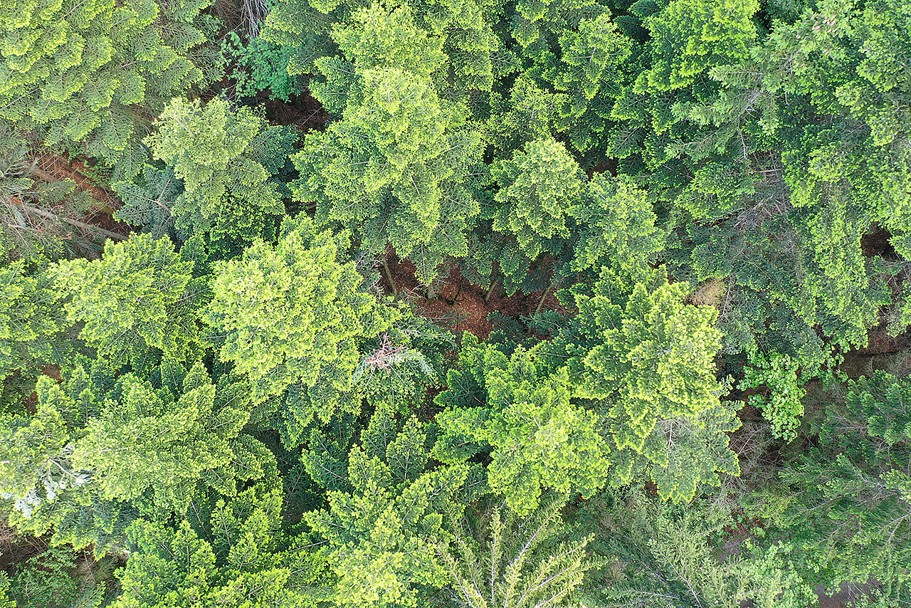
This was reported by Mueller's colleague Dr. So-yeon Bae with an international team in Nature Communications. The South Korean landscape ecologist has shown in the research project DFG Biodiversity Exploratories that radar data from satellites are surprisingly well suited for describing the diversity of vertebrates, plants and fungi in forests, as well as the smallest insects and spiders. This is despite the fact that radar data are relatively coarse and despite the fact that forests with their highly dynamic and complex three-dimensional structure represent a particular challenge for monitoring biodiversity.
Twelve species groups analysed in five forest areas
The JMU-led research team compared two methods. In five forest areas, whose biodiversity was very well known by by ground truths, twelve species groups were analysed – on the one hand with high-resolution laser scanning data and on the other hand with coarser radar data.
The results were astounding: "The free radar data provide comparably good results and are sometimes even superior to the laser," says Dr. Bae. Her conclusion: "Remote sensing is ready to carry out biodiversity monitoring from space throughout Germany. Now only better, standardized biodiversity data have to be collected on the ground nationwide". This would require spatially distributed mapping of species diversity in all forest habitats in Germany.
Publication
Radar vision in the mapping of forest biodiversity from space, Nature Communications, 18 October 2019, https://doi.org/10.1038/s41467-019-12737-x
Contact person
Prof. Dr. Jörg Mueller, Ecological Station of the University of Würzburg, T +49 931 31-83378, Mobile +49 160 90966475, joerg.mueller@uni-wuerzburg.de
Additional images
 that lives hidden in deadwood in the forest. Diversity of this cryptic and tiny deadwood living organism can be well described and predicted by radar data.")